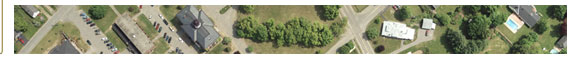
Aerial Photography:
- Vertical
- Oblique
- Spot Shots
- Black & White
- Color
- Extensive Film Library
|
Topographic Mapping:
- Design
- Planning
- Municipal
- Landfill
- Mining
- Flood Study
|
Photo Lab:
- Film Processing
- Color Prints
- Back & White Prints
- Film Diapositives
- Enlargements
- Photo Mosaics
- Orthophotos
- Scanning
|
Municipal Mapping:
- Base Mapping
- Composite Parcel Mapping
- Shoreland Zoning Maps
- Municipal Zoning and Land Use Maps
- Street Maps
- G.I.S. Applications
- Forest Resource Maps
|
Photogrammetry:
- Digital Mapping
- Utility Mapping
- Digital Orthophotography
- Volume Computations
- Cross Sections
- G.I.S. Applications
- Aero-Triangulation
- Control Surveys
|
Tax Mapping:
- Annual Maintenance/Updates
- Recompilation
- CAMA Database Review
- House Numbering
- G.I.S. Applications
- Reductions
- Acreage Determination
- Land Classification
|